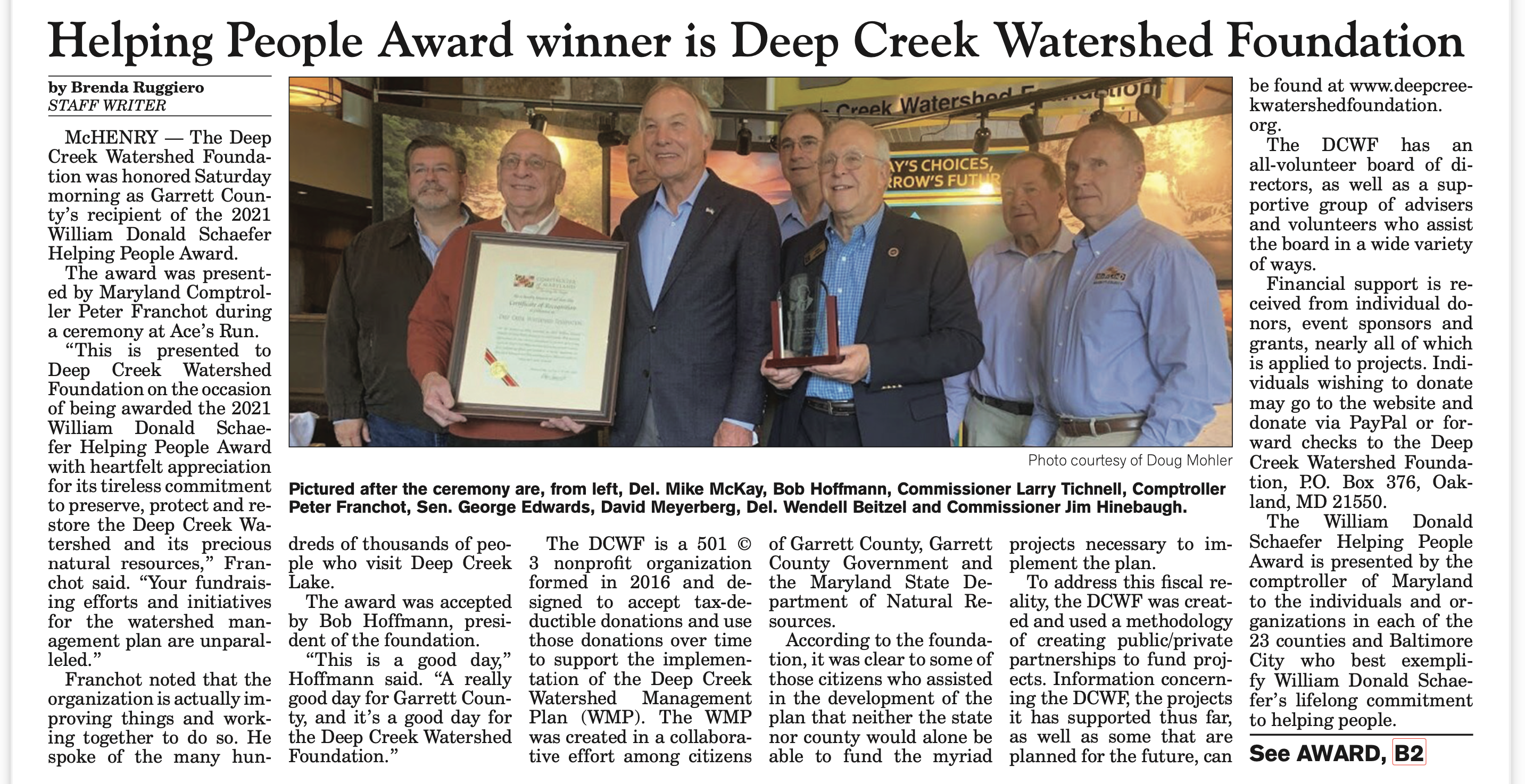
Helping People Award winner is Deep Creek Watershed Foundation


The time-rate of shoreline changes can be documented by rubber sheeting the photos onto a base map using features visible on the base map and on each sheet as it is brought in. Because of the spatial size of the project, it will need to be done digitally. From the file, the time rate of shoreline change can be documented and evaluated. The project partially fulfills Goal 3 of the Watershed Management Plan.
Our next objective is to accrue donor funding of $21,750 in capital costs and a commitment of $17,970 for annual operation and maintenance for the gauge on the river upstream of where Deep Creek joins the Youghiogheny. The existing flows at that point subtracted from the flows measured at the Hoyes Run gauge will indicate the discharges from the Deep Creek watershed, including flows from the power plant and groundwater discharges.
The Completed Water Budget Model will be able to account for precipitation, groundwater recharge, flows through the power plant plus the discharges around the dam, factoring in the discharges required through the power plant by the Water Appropriation Permit. An apparently simple relationship determines the water levels in the lake: Water In – Water Out = Change In Water Level.
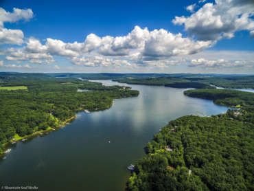
A recent bathymetric survey of Deep Creek Lake confirmed the Stage-Storage relationship determined when the lake was built by Youghiogheny Hydro-Electric Company. The project partially fulfills Goal 1 of the Watershed Management Plan.
The new USGS flow gauge upstream of the Swallow Falls Bridge on the Youghiogheny River will measure the river flows upstream of the power plant. The difference in flows, adjusted for travel time, will afford an indication of the discharges from the Deep Creek Watershed.
The discharge from the watershed (Water Out) is a component in the analysis of the groundwater recharge and the precipitation (Water In). The other component is a record of lake water levels.The public doing recreational boating and swimming in the river reach from Swallow Falls to the Sang Run Bridge will be safer because the river flow rate is conveniently available on the USGS
website.
Legislation is needed to address the lack of enforceable regulations regarding the launch and operation of boats that have been exposed to aquatic invasive species (AIS). The Policy Review Board* has formed a committee managed by Eric Null and Bob Browning. The Assistant States Attorney assigned to Deep Creek Lake has agreed to help craft the legislation. At this time the costs to the Foundation are unknown. The project partially fulfills Goal 3 of the Watershed Management Plan.
* The Policy Review Board (PRB) is a Maryland State Board which is charged with advising the Department of Natural Resources (DNR) on matters relating to lake fees, budget and management. In addition, the PRB and DNR were mandated to issue a Deep Creek Lake Recreation and Land Use Plan by June 2001 that provides for the wise use, protection and management of the natural and recreational resources of Deep Creek Lake. More information about the PRB can be found at the website for the Department of Natural Resources.
The two new USGS precipitation gauges will augment the USGS recording gauge at North Glade Run and afford reasonably good precipitation records. An analysis of the lake levels USGS measures on our behalf compared to the precipitation will show the relationship of groundwater recharge to the precipitation record. The first precipitation gauge was added to the stream flow measurement at Hoyes Run near the power plant. The second was added to the stream flow gauge at Cherry Creek. The installation cost is $8,155 each, and the annual operation and maintenance cost is $4,575 each. The project partially fulfills Goal 12 of the Watershed Management Plan.
The goal of the 10 in 10 Project is to reforest the buffer strip along the Lake shore with at least 10% of woody vegetation in 10 years using native trees shrubs and ground covers. A demonstration project in partnership with the Lake Management/DNR office at Deep Creek Lake State Park will be displayed along the 300 yard strip of waterfront to the right of the Launch Dock. This display will serve as a prototype. The purpose for a vegetated barrier is not just to prevent erosion but also to protect the water quality and shore and stream habitat.
Visitors to this site will find a meandering path and signage that identifies suggested landscaping plants all designed to enhance lake views while creating a healthy shoreline. Participation of property owners is voluntary. Other community partners include Property Owners Association (POA), various civic groups and Ashley Bechtel-Bodkins, one of our advisors and a Senior Agent at University of Maryland Extension Office in Garett County who will be involved with the planning.
DCWF does not have a cost estimate at this time. The 10 in 10 Project partially fulfills Goal 6 of the Watershed Management Plan. The Plan will be posted here upon completion.
In partnership with the Lake Manager and Garrett College, we purchased jackets and inspection equipment for the launch stewards stationed at the State Park Launch Ramp. We have committed $1,000 per year to support this effort. This project partially fulfills Goal 1 of the Watershed Management Plan.
The installation was completed in August 2020 at the cost of about $6,000, and an annual maintenance cost of about $9,000 since then. The United States Geologic Survey has installed and maintained the gauges and is paid for by the Foundation. The data from these gauges are available on our website and on the USGS website. These projects are in partial fulfillment of Goal 1 of the Watershed Management Plan.

The water level and temperature gauges require regular calibration and routine maintenance. The water level gauge initially encountered difficulty dealing with ice formation in the initial location. The gauge was quickly reinstalled with no problems getting measurements since.
The water level data on the USGS shows both elevations based on geodetic basis and on the lake basis. The lake basis assumes that the elevation of the overflow weir at the dam is at elevation 2462. The geodetic elevation is 1.82 feet higher than the lake elevation.
Eric Null, the Lake Manager, has noted the utility of continuous temperature monitoring for our Eutrophic lake: “There are three basic types of lakes, Dystrophic, Eutrophic, and Oligotrophic. Dystrophic lakes have no oxygen, while Eutrophic lakes have their greatest amounts of oxygen at the surface. Oxygen then decreases as you increase depth. Oligotrophic Lakes have evenly distributed oxygen. Oligotrophic lakes do not turn over seasonally, therefore, have a very low nutrient concentration (infertile). Eutrophic lakes turnover seasonally due to their stratification of oxygen, temperature, and nutrients.
This turnover is essential for life in a Eutrophic lake. Every spring as the temperature rises and warms the water’s surface to the temperature of the bottom of the lake (lakes can stay 40+ degrees on the bottom during winter), the wind mixes the surface with the deeper water, the wind continues to mix the water until the top layer of water slides beneath the bottom layer. The bottom becomes the top and brings all of the nutrients that fell to the bottom (dead organic matter) to the surface of the lake where they can be processed by biological organisms. In fall, the same event happens in reverse. As the surface water cools, it becomes denser and pushes the warmer bottom water to the surface with all of the summer nutrients. These events cause cloudy water that can be tinted green. The cloudiness is nutrients and the green are phytoplankton, the beginning of the lake’s food chain.
These nutrients fuel life in the lake through the winter and the summer. Without the natural turnover phenomenon, a Eutrophic or Mesotrophic (a high-quality eutrophic lake) lake could not sustain life. Temperature is vital for fishing, especially during turnover. During turnover, the surface’s temperature, nutrient, and oxygen concentration change dramatically for a week or two, forcing fish to the bottom of a lake and suppressing their appetites. Also, temperature dictates
where certain fish species will be feeding in a lake. Temperature stratification of a lake in summer is the key factor to fishing success.

This program is consistent with Deep Creek Watershed Plan Goal 6: Prevent erosion and sedimentation to the greatest extent possible to protect water resources from increased sediment loading and associated water quality problems, and its Objective 3: Revise, streamline, and incentivize lake shoreline protection measures and permitting.
According to the Plan: The primary sources of sediment in the watershed, in no particular order, are:
The Watershed (Plan) Administrator and staff in the University of Maryland’s Extension services have examined and prioritized this issue as a significant and reachable goal/objective. Indeed, the University of MD Extension service has been running programs and is already maintaining a website regarding homeowner stormwater practices. In addition, the Extension service has on its staff a great team of watershed specialists who have led and will continue to lead educational programs about
stormwater management.
We, along with the Garrett College’s Continuing Education & Workforce Department, and the Garrett County Government, sponsor the University of Maryland Extension Service’s public presentations on managing stormwater runoff. The problem is especially severe when rainwater runs over hard surfaces, such as driveways and rooftops, picking up sediment, chemicals, debris and toxins that are carried into local streams.
The Extension Service’s presentations cover the use of rain barrels and cisterns, rain gardens, conservation landscaping and riparian buffer planting, among other ways to ameliorate runoff and prevent erosion. These sessions are presented by Ashley Bodkins, who also is an advisor to the Deep Creek Watershed Foundation.
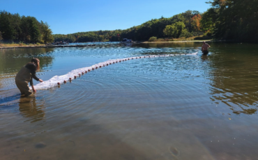
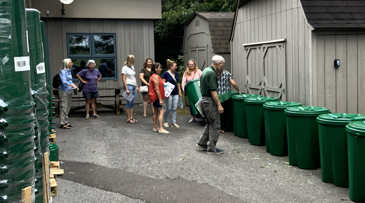
To date this project has distributed over one hundred rain barrels to reduce the impacts from rooftop runoff with financial help from the Community Trust Foundation.
This project partially fulfills Goal 6 of the Watershed Management Plan.
Part of the Water Budget Model design work includes an evaluation of impacted docks at the water levels contained between the Rule Bands. According to the report, there are 2,233 docks on the lake. At the end of August, the Lower Rule Band (LRB) is at 2458, and 202 docks, 9% of the total, are impacted by low water. At the end of September, the LRB is at 2457, and 267 docks, 12% of the total, are impacted. At the end of October, the LRB is at 2456, and 335 docks, 15% of the total, are impacted by low water.
The dock impacts from lowered water levels study was done by Century Engineering in Oakland, Maryland and cost about $30,000. This project partially fulfills Goal 10 of the Watershed Management Plan.